The Myth Of App Dominance: Why Your Digital Crutch Fails

Overloaded Features Hide Critical Vulnerabilities
You want to believe one app handles everything because admitting otherwise means accepting you’re dependent on a fragile system. The real problem: apps designed for casual users pile features into a single interface, and each feature adds code paths where failure cascades. Garmin BaseCamp, AllTrails, and similar tools promise comprehensive solutions. They deliver decision paralysis instead. More buttons mean more places for bugs to hide, and in off-grid terrain, a hidden bug is a navigation failure waiting to happen.
The mechanism comes from software engineering: every feature increases what engineers call surface area for defects. An app showing weather, elevation data, satellite imagery, routing algorithms, and user-generated trails all in one interface creates interdependencies. When one data source fails or updates incorrectly, it doesn’t just break that feature. It corrupts the map cache, triggers false GPS corrections, or locks the interface entirely. You’re not getting robustness. You’re getting a system that fails in ways you can’t predict or work around in the field.
Battery Drain Versus Critical Reliance
The hard truth: phones and tablets drain faster under load than manufacturers admit, and your dependency on constant app function accelerates that drain. Navigation apps running GPS, data syncing, and screen-heavy interfaces consume 15-20% battery per hour under real field conditions. You don’t know how long your route takes until you’re committed to it. By then, your battery life estimate means nothing, and your app becomes a liability instead of an asset.
This isn’t a recharge problem. It’s a protocol problem. Most users treat battery as a secondary concern until it becomes the primary one. The mechanism is simple: critical reliance on an app forces you to keep running it constantly, which prevents you from using battery conservation strategies like turning off data sync, reducing screen brightness to actual readability thresholds, or switching to offline mode preemptively. Your app forces you into a dependency loop where you can’t afford to turn it off because you’re terrified of being lost. That fear is the real vulnerability, and the app manufactures it.
The Redundant Pathfinder Protocol: Analog Backups For Digital Failure

Physical Maps As Ultimate Failsafe
You want the app because it feels modern and safe. The real reason you need paper is that digital systems fail exactly when terrain becomes unforgiving. In military logistics, they call this redundancy “defense in depth”—layering systems so one failure doesn’t cascade into total collapse. Your phone battery dies. Your signal vanishes. Your app crashes at a canyon fork. Paper doesn’t.

Physical maps operate on a different failure mode entirely. They require no power, no connectivity, no software update. A 1:50,000 topographic map shows elevation contours, water sources, and terrain features that persist whether your device works or not. The map doesn’t change. The terrain does, but slowly. You need current mapping data for your region before departure.
- 1:50,000 Topographic Maps: Standard resolution for overland navigation. Shows contour lines, water features, roads, and settlement density. Precise enough for route finding without excessive detail overhead.
- Regional Government Survey Maps: USGS in North America, Ordnance Survey in the UK, equivalent agencies elsewhere. These carry legal authority and accuracy standards that commercial maps often skip.
- Waterproof Variants: Paper fails when wet. Synthetic materials and sealed edges extend usability. Heavier than standard but critical for water crossings and high-humidity environments.
- Overlay Grids and Coordinates: UTM or latitude/longitude grids allow cross-reference with GPS devices and compass bearings. Ensures your analog system talks to your digital tools when both function.
- Local Route Annotations: Mark waypoints, known hazards, water caches, and shelter locations directly on the map before departure. This transforms a static document into a decision tree specific to your journey.
The mechanics work like this: you correlate your map’s grid to GPS coordinates from your app while systems are operational. If digital fails, you navigate by terrain matching—identifying ridgelines, valleys, and landmarks against contour lines. Paper becomes your insurance policy when the technology fails, not your primary tool.
Compass Mastery: Fundamental Orientation
Compass navigation isn’t romantic nostalgia. It’s a mechanical system that works when every electronic alternative has stopped. Magnetism doesn’t require batteries or satellites. Your body can orient relative to north through declination adjustment and basic trigonometry.
Most people use compasses wrong. They treat it as a pointer instead of a measuring instrument. A baseplate compass lets you transfer bearings between map and terrain. You align the compass housing with your intended route on the map, rotate the dial until orienting lines match grid north, then turn your body until the magnetic needle aligns with the orienting lines. That bearing stays constant regardless of terrain. You walk it.
The declination matters everywhere outside magnetic equators. In North America, declination ranges from 20 degrees east on the Pacific coast to 10 degrees west on the Atlantic. Ignore this and your bearing drifts sideways across miles. Adjust the compass housing or recalculate manually each time you switch regions. Your app shows current declination for your location if you check before departure. Write it on your map.

Compass proficiency solves a specific problem: you maintain azimuth across featureless terrain—desert, snow, fog, dense forest. Your map shows direction. Your compass confirms it. Your body walks the bearing even when visual landmarks disappear. This is the mechanism that keeps you moving when electronics fail and visibility collapses. Verify your bearing every thirty minutes against terrain features. When terrain matches map, you’re positioned correctly. When it doesn’t, you’ve drifted and caught it.
Overland Communication Beyond Satellites: Off Road Communication Tips
Radio Protocols: Reliable Short Range Comms
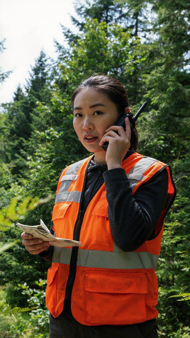
You want satellite comms because it feels like a safety net you can buy. The real mechanism is simpler: radio protocols work because they don’t depend on corporate infrastructure or coverage maps. VHF and UHF radios transmit line-of-sight within 5 to 50 kilometers depending on terrain and antenna height. Your navigation app shows the route, but a handheld radio keeps your convoy synchronized when cell towers vanish. Programming frequencies before departure matters more than owning expensive hardware.
The mistake most people make is treating radios as a backup to their phone. They’re not. Radios operate on open frequencies and simplex channels designed for convoy coordination. You establish check-in intervals, use standardized phonetic alphabet for clarity, and assign roles: lead vehicle, sweep vehicle, navigator. Test every radio at camp before moving. Dead batteries and poor antenna placement kill communication faster than any terrain.
Emergency Beacons: Last Resort Signals
An emergency beacon fires when your app stops being useful. Personal Locator Beacons and satellite messengers like Garmin InReach operate on different architecture: PLBs broadcast distress signals to search and rescue networks; satellite messengers handle two-way communication and check-ins. Both require line-of-sight to sky. A PLB activates only in genuine emergency, triggering a costly rescue response. A satellite messenger lets you ping your location hourly or send text messages, turning it into navigation redundancy, not just crisis response.

The mechanism is registration and uptime. A beacon without registration on official databases becomes noise. Your device won’t summon rescue if emergency services can’t identify the signal source. Charge these devices independently from your vehicle battery. Mount them where they access open sky, not buried in a pack or jammed under seats. Test the emergency button workflow in your planning phase so muscle memory kicks in if panic makes thinking difficult.
Pre Trip Recon: Intelligence Preparation For Off Road Adventure Routes

Observe, Orient, Decide, Act Before You Leave
You want confidence that you won’t get lost. That’s the real reason you’re reading this. The military borrowed the OODA Loop from fighter pilot John Boyd, and it maps directly onto route planning: Observe means collecting raw data about terrain, Orienting means filtering that data through what your app can and cannot show you, Deciding means choosing your actual route, and Acting means committing to waypoints before you drive. Most people skip Observe and jump straight to Act. They load a map, draw a line, and go. That’s backwards.
Your overland navigation app is only as useful as the information you feed it before departure. Apps like Gaia GPS, Avenza, or AllTrails show terrain, but they don’t think about water crossings, rockfall zones, or sections where GPS signal drops. You have to do that work yourself. Spend time cross-referencing satellite imagery, user forums, and trip reports against what your app displays. Build a mental model of where your app’s data is incomplete, outdated, or wrong. This step determines whether you navigate or just react.
Weather And Terrain: Predicting What Maps Hide
Weather and terrain data sit in different systems, and most overland navigation apps treat them as separate problems. They shouldn’t be. A route that’s passable in dry conditions becomes impassable after rain because the ground composition changes. Apps show elevation and vegetation density, but not soil type or drainage patterns. You need to cross-reference weather forecasts with satellite images to spot areas likely to be muddy, flooded, or unstable during your travel window.

Terrain analysis means looking at slope angle, aspect, and vegetation to predict traction and visibility. A rocky slope facing south will be drier than one facing north in most climates. Apps overlay this data visually, but you must interpret it. Download satellite imagery at different seasons if available through your app or through external sources like Google Earth. Then compare conditions reported in recent trip logs. Build a private notes section in your app flagging sections where conditions change rapidly, where signal loss is known, or where reroutes are common. This prevents you from discovering unknowns while driving.
Beyond GPS: Finding Local Roads For Navigation & GPS Alternatives For Navigation
Reading The Land From Topographic Maps
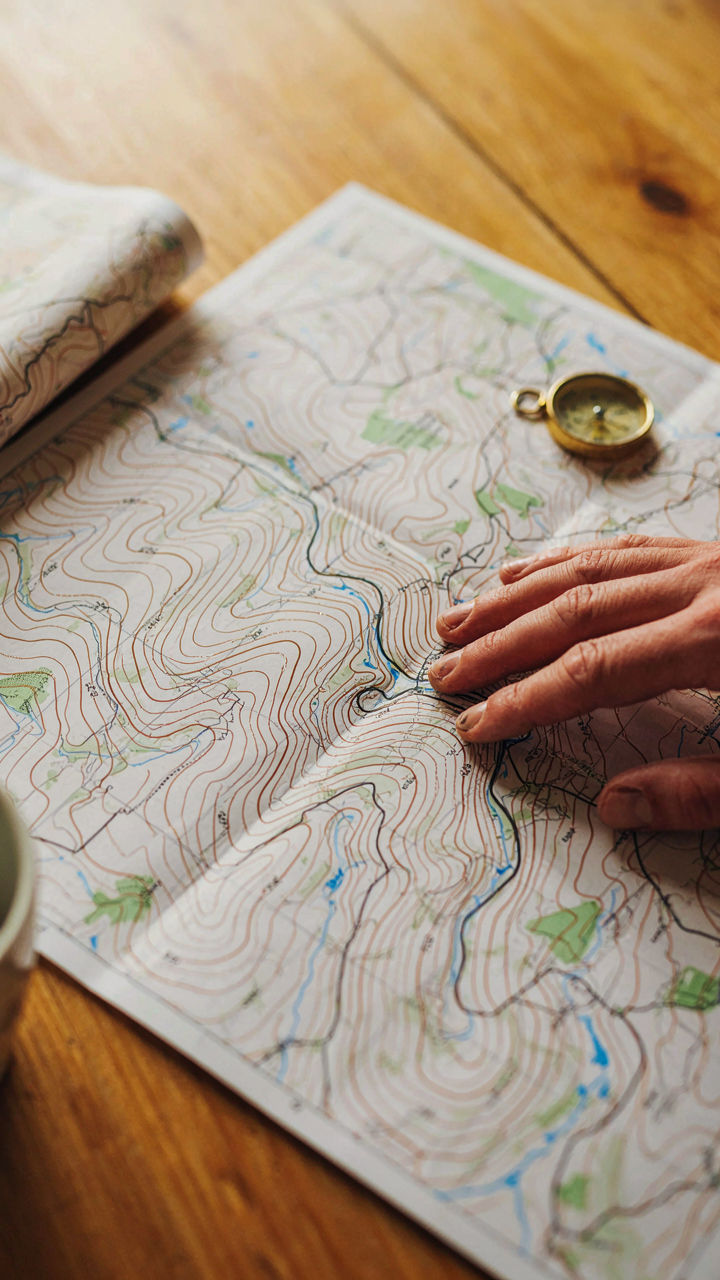
You want this section because you fear being helpless when your phone dies. The real mechanism is pattern recognition. Topo maps show what GPS apps hide: the actual terrain logic that determines where people built roads. Contour lines aren’t decoration. They’re a language describing slope, drainage, and passage difficulty. Learn to read them and you stop needing the app to tell you where to go.
Topographic maps use contour intervals, usually 40 or 100 feet depending on terrain. Close lines mean steep ground. Spaced lines mean gentle slopes. Roads follow the path of least resistance, which topo maps make visible instantly. You spot creek valleys, ridgelines, and saddle points where passes exist. Apps like Gaia GPS and OnX Maps let you download topo data offline, but the paper version teaches you how to think spatially instead of how to swipe. That shift is the only insurance that matters when navigation fails.
Celestial Navigation: Ancient Wisdom Reimagined
Navigation belongs to the field of astronomy, not just geography. The mechanism is triangulation through fixed celestial references. Stars and sun positions don’t move with politics, signal strength, or software updates. They’re absolute. Most overland apps include basic compass and sun-azimuth tools now, but you’re using them as a crutch if you can’t estimate direction without them.

The Polaris star marks true north in the Northern Hemisphere. The Southern Cross does the same in the Southern. You don’t need instruments. Your hand spans roughly ten degrees of sky. Knowing this and three bright reference points means you can navigate for weeks without electronics. Apps like Stellarium teach you constellations and their positions, but the skill that survives is mental. When your battery dies at mile 250 in the Atacama, the app doesn’t help. Your ability to hold a bearing by starlight does.
Vehicle Navigation System Setup: Integration Vs. Independence
Hardwired Systems: Power Stability Insights
You want the integrated setup because it feels professional and permanent, but that’s exactly the trap. Think of electrical systems like load distribution in civil engineering: a single point of failure upstream kills everything downstream. Factory-integrated nav systems draw power from the vehicle’s main battery and alternator circuit, meaning voltage sags, parasitic drain, and charging issues affect both your rig and your navigation simultaneously.
Most hardwired systems integrate through the OBD-II port or factory head unit connector. This saves wiring but creates dependency. If your battery voltage drops below the system’s minimum threshold during extended idling or cold starts, the nav unit shuts down mid-route. Older vehicles compound this: the charging system may not stabilize voltage fast enough under load, leaving your navigation unreliable exactly when terrain demands it most. The mechanism is simple: shared power means shared vulnerability.
Detached Units: Redundancy For Failure
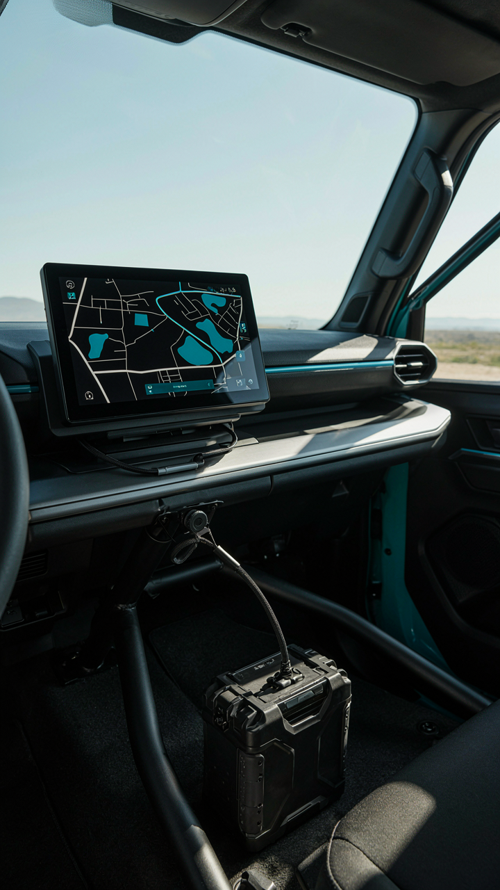
Portable units sit independent of your vehicle’s electrical architecture, which sounds like a downgrade until the alternator fails at mile 200 in the Mojave. A standalone GPS device with its own battery operates on a separate power circuit entirely. If your truck’s electrical system fails, you still navigate. If your navigation app crashes, your truck still runs. Separation creates redundancy by design, not by luck.

Mount a dedicated unit on your dashboard or rig plate with its own power source routed through a separate fuse and battery terminal. This adds wiring complexity upfront but eliminates the shared failure mode that kills integrated systems. When your primary nav dies, a backup detached unit becomes your only option on route. The protocol is direct: one unit per critical function, never stacked dependencies.
The Unspoken Community: RVillage App & Best RV Camping Apps For Organic Intel
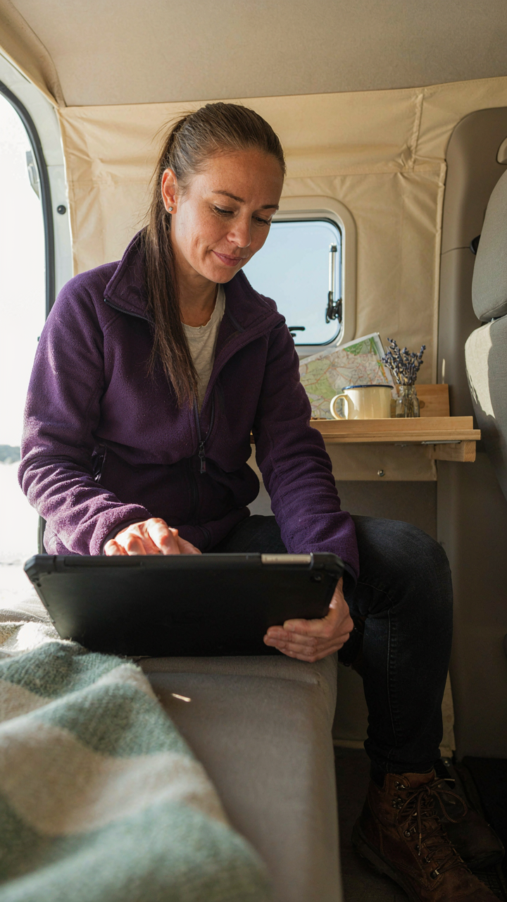
When Real Overlanders Share What Maps Won’t Show
You want certainty. You want to know the road won’t wash out, the water source still flows, and the camp spot isn’t blown. That’s fear dressed as planning. RVillage operates like a distributed intelligence network in military doctrine: individual nodes report conditions, the system aggregates signal from noise, and users consume actionable intel instead of guessing. The app crowdsources trip logs, photos, and real-time updates from people who drove the route last week, not last year.
The mechanism is simple: RVillage users upload GPS tracks, camp photos, and condition reports tied to specific locations. You see water availability at coordinates, road damage from recent weather, and whether a gate is open or locked. The app timestamps everything, so fresh reports overwrite stale ones. This beats static map data because roads in remote terrain change faster than publishers update their databases. You’re not reading consensus. You’re reading what actually happened.
- Trip Reports with Timestamps: Users document when they traveled a route and what they found. This matters because a dry wash in August looks different in April after runoff.
- Photo Verification at Waypoints: Overlanders upload images tied to GPS coordinates. You see camp conditions, gate status, and road quality from multiple angles before committing your rig.
- Real Time Water and Fuel Intel: Community markers indicate which water sources still flow and which fuel stops operate. Static apps can’t compete with this lag.
- Road Condition Alerts by Weather: Users flag washouts, mud, and seasonal hazards. Alerts tie to recent weather events, so you know what triggered the damage.
- Camp Spot Density Mapping: The app shows how many overlanders used each location over time. High density means proven ground; gaps suggest untested terrain.
RVillage’s advantage collapses if the community stops reporting. The app depends on volume and honesty. If users don’t upload their trips or cherry pick only positive posts, the intel decays into marketing. The best overlanders treat condition reporting like a protocol: upload before leaving, flag problems, upload photos. Consistency compounds over months and years into a usable knowledge base that no publisher can replicate.
The Routes Nobody Find Because Nobody Ask
Everyone follows the established trails because guidebooks exist for them. Hidden gems stay hidden because they require two things: direct human contact and willingness to look past the obvious. RVillage solves the first. Community forums and in-app messaging connect you to overlanders who’ve worked specific regions for years. They know where water sources hide, which side roads avoid crowds, and which remote camps hold through the dry season because they’ve been there multiple times.

The real mechanism isn’t the app. It’s the person on the other end who answers your question. An overlander who drove a region fifty times sees patterns that apps can’t encode. They know which seasonal route opens first, where wildlife congregates, and which camps the agencies haven’t shut down yet. You get this knowledge by asking directly, not scrolling feeds. Send a message to someone whose trip log covers your target area. Ask about water. Ask about alternatives to the main road. Ask what changed since their last visit. Most overlanders answer. They remember being new to a region.
Building this relationship takes time. Start by engaging with trip reports from overlanders who drive your target zone. Comment on their photos. Ask clarifying questions in their posts. Show you’re serious, not just collecting free beta. Once someone knows you’re not a tourist looking for Instagram content, they share the routes they protect. This is how overland navigation actually works at the edge: information flows through trust, not interfaces. The app is just the medium. The community is the map.
The Minimalist Mindset: Less Tech, More Competence

Skill Development Beats Battery Life
You want this section to validate that apps alone are enough. They’re not. The real mechanism here borrows from skill acquisition in athletics: progressive overload. You cannot progressively overload your navigation competence if the app makes decisions for you. Every feature that automates reduces the load on your decision-making muscle.
Most overland routes fail not because the app failed, but because the driver never learned to read terrain, recognize landmarks, or triangulate position manually. The app creates learned helplessness. You memorize screen icons instead of map symbols. You follow a blue line instead of understanding why that pass exists. Start now: print your route, study it daily for two weeks before departure, then navigate it once without opening the app.
Analog Tools Build Real Certainty
Paper maps don’t need satellites, charging cables, or software updates. That’s the actual advantage everyone states wrong. The real advantage is friction. Paper forces you to make navigation decisions at scale, pre-departure, when stakes are zero. Digital apps let you defer decisions until you’re lost. A map and compass make you responsible for your position. An app makes you responsible for trusting an algorithm.

Carry a waterproof paper map and a basic compass for every trip, even short ones. You learn the landscape structure, not the interface. You notice terrain changes apps filter out. You build spatial memory instead of sequential route memory. Practice triangulation monthly on familiar terrain. When your phone dies at mile seventy, you’re not stranded, you’re on schedule.
Your Greatest Obstacle Isn’t The Map; It’s The Illusion Of Digital Infallibility

Most people download an overland app and assume the pixels solve the problem. They don’t. Apps fail. Batteries die. Signal vanishes. The real skill lives in your ability to read terrain, trust your instincts when the screen goes black, and know when the algorithm is steering you wrong. Download your app today. Then spend an hour with a paper map in the same area. The gap between what you see and what the device shows you is where competence lives. Technology amplifies your navigation ability only if you don’t worship it.